The high degree of fluidity of this lava-stream [at Santiago] was at once evident, from its smooth and gently sloping surface, from the manner in which the main stream was divided by small inequalities into little rills, and especially from the manner in which its edges, far below its source, and where it must have been in some degree cooled, thinned out to almost nothing; the actual margin consisting of loose fragments, few of which were larger than a man’s head.
— Charles Darwin, Geological Observations on Volcanic Islands
Effusive basaltic lavas produce two general types of flow morphologies, a’a and pahoehoe, Hawaiian words meaning “hurt” and “ropy,” respectively. A’a lava is sharp and blocky; it hurts to walk on the sharp-edged surface of an a’a field. Pahoehoe lava, on the other hand, forms smooth flow surfaces with a generally ropy texture that can be walked upon barefoot with no discomfort at all. Of the two, a’a is the most abundant in the Galápagos, but least seen by tourists because the National Park’s visitor sites generally do not include a’a flows for obvious reasons. There are, however, several places where they can be seen. The trail at Punta Espinoza, Fernandina, begins as a pahoehoe flow but ends at a point where the pahoehoe has been converted to a’a. The trail at Bahia Urvina, passes by an a’a flow and a large a’a flow runs along the road leading up to Sierra Negra from Puerto Villamil.
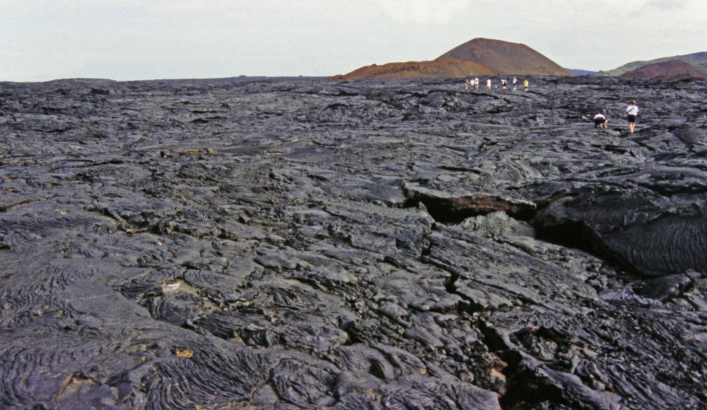
Although these two types of flows have distinctly different appearances, their chemical make-up may be quite similar, and they are frequently formed during the same eruption. The two biggest factors in determining which type of lava is produced are the effusion rate and the viscosity. At higher flow rates over steeper terrain and greater viscosities, the surface of the flow continually breaks into rounded and cauliflower-shaped fragments that form an a’a flow. At lower flow rates and greater fluidity, the surface of the flow cools into a hardening crust that is gently rolled into thin rope-like pleats. A’a and pahoehoe, however, are merely end points in a continuous spectrum. As a flow begins to wane and the lava becomes more viscous, pahoehoe can transform into a’a. A’a, however, rarely ever transforms into pahoehoe.
In a viscous a’a flow, the outer skin forms a rubbly, sharp-edged surface. As the flow moves along, the surface rubble at the edge of the flow falls off of the front edge and is over-ridden. Thus, a cross-section of an a’a flow reveals a rubbly surface, a solid inner layer of slowly cooled lava, and finally a narrow zone of over-ridden rubble.
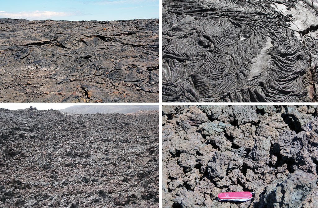
Bottom: A’a flow, Volcán Chico, on the slope of Sierra Negro, Isabela.
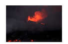
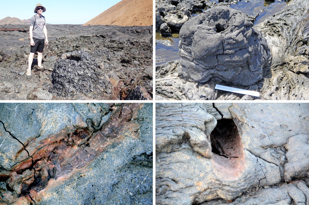
During a pahoehoe flow the surface loses heat by radiation and becomes viscous, insulating the underlying lava, which remains liquid and continues to flow. The cooler skin is carried along, crumpling and folding into twisted shapes. Early in the flow, when the lava is hotter, these twists have the appearance of ropes, but later, as it cools and becomes more viscous, the twists are shaped more like entrails. Occasional breaks in the crust are quickly sealed when fresh lava wells up, toothpaste-like, into the crack. Sometimes the leading edge cools to a point where it blocks the advance of the flow. As the eruption continues, more molten lava accumulates behind the frozen edge, causing the flow to swell, producing a gently rolling, hummocky surface. Occasionally so much lava accumulates in a flow that it swells into large pressure ridges, tumuli, that may split along the top. When the eruption finally ends, the lava underneath the crust may drain away leaving cavities into which the crustal roofs ultimately collapse. At Punta Moreno (see below) one year, my foot broke through the surface of the flow. Fortunately, the chamber wasn’t deep, almost to my knee, and I pulled my leg out all bloody. It looked bad, and potentially it could have been serious, but I only suffered a bunch of minor scratches.
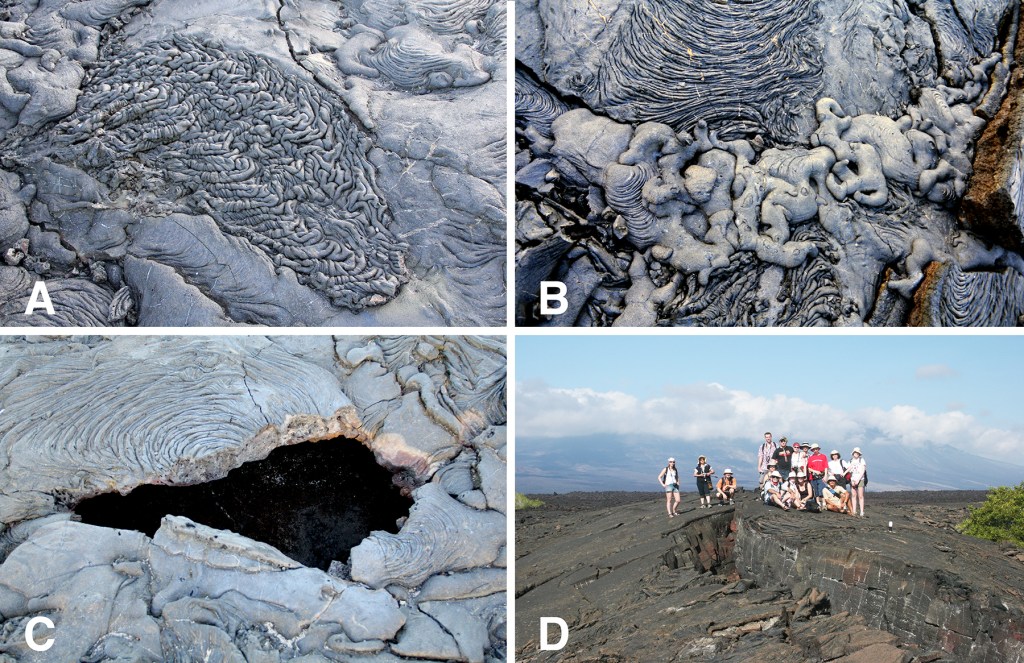
Sometimes pockets of trapped gas burst from the surface of the flow building hornitos (Spanish for “little oven”), tiny cones formed when gobbets of lava thrown up by released gas falls back and piles up into a little mound around the vent. Hornitos can also be formed when lava along the coast flows over a puddle of water that then flashes to steam. Other features of pahoehoe flows are tree molds that form when lava flows up against a tree and then chills, creating a mold. After a few moments the tree bursts into flames and is destroyed, but its surface is forever impressed on the chilled lava left behind.
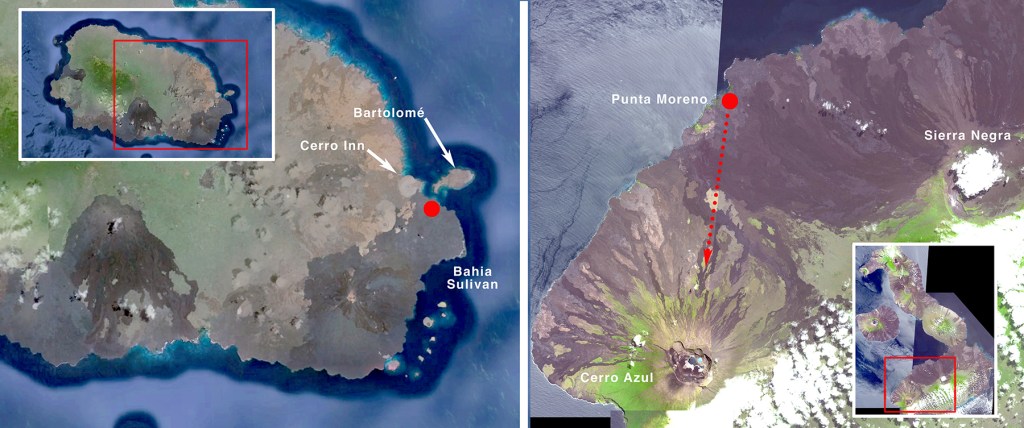
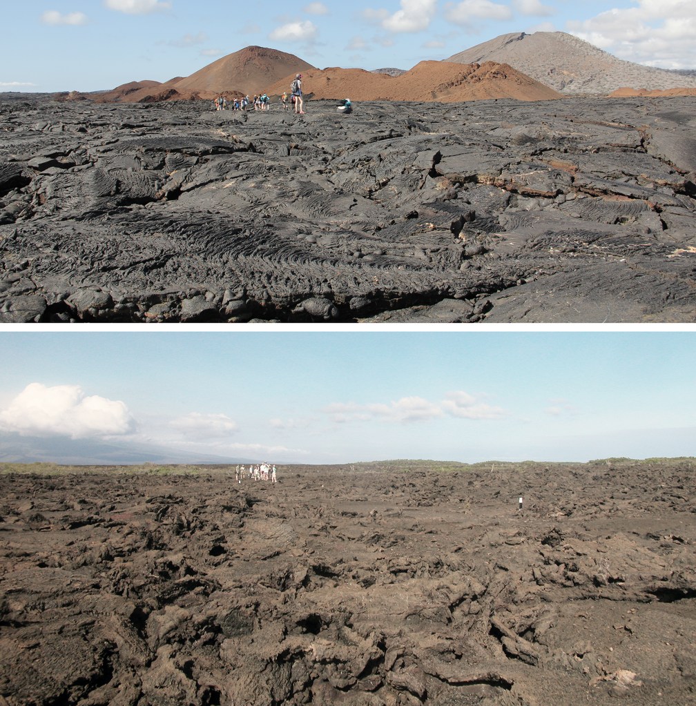
Just before the turn of the 20th century, massive lava flows covered the southern part of Santiago, extending from Bahia James on the west side around to Bahia Sulivan on the east. Visitors who walk on the Sulivan bay flow are often profoundly affected by the seemingly endless bareness of the lava. The pahoehoe flow at Punta Moreno, Isabela, at the foot of Sierra Negra, is similar to Bahia Sulivan but was emplaced 200 to 1000 years ago, and the differences are dramatic. While the younger flow is jet black and nearly intact, the older lavas at Punta Moreno have oxidized from shiny black to rusty red-brown, and the roofs of vacated chambers have collapsed in many places. Stepping over the lava fragments results in loud clinking sounds (these rocks are often called “clinkers”).
At Bahia Sulivan there is little in the way of plant life except for a few scattered early pioneer plants, Mollugo flalvescens and lava cactus, Brachycereus nesioticus, both endemic, while at Punta Moreno there is a much greater variety of plants growing there, especially around pools in basins that are connected to the nearby ocean.
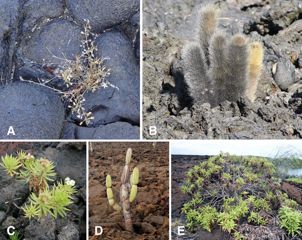
Bottom: Darwin’s daisy, Darwiniothamnus lancifolius (C), candelabra cactus, Jasminocereus thouarsii (D), and Scalesia affinis (E). All five are endemic.
Find out more about Galápagos Geology in Volume 1 of
A Paradise for Reptiles.