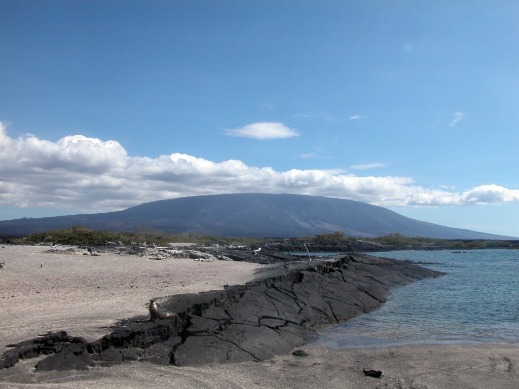
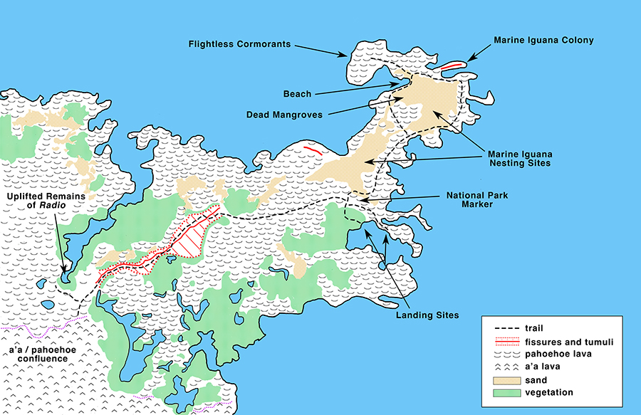
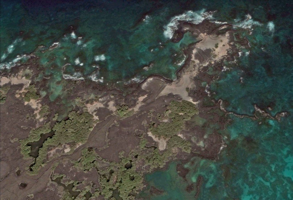
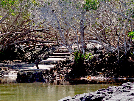
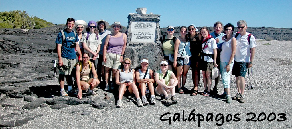
Punta Espinoza, the only visitor site on Fernandina, is the result of several uplifts. The uplift in 1927 was so sudden that two fishing boats that were anchored nearby were nearly caught, while a third actually was stranded. Along the trail one can see the remains of mangroves that were lifted high and dry. There are two landing points. The first is a stone and cement jetty that leads through a short tangle of mangroves, while at the second, visitors merely climb out of the panga onto the lava, which can sometimes be very slippery, so care must be taken. The use of one or the other depends on the tide. In 1994 an uplift raised the jetty by 20 to 36 inches, so it is only usable at high tide. On one of my trips, the tide was high enough that water just barely covered the jetty and three sea lion pups were using it as a slip ‘n slide. Once past the landing point, visitors encounter a national park marker. Some time after the photo below was taken a partial whale skeleton was placed in front of the marker. The trail consists of two parts, a right-hand branch that is rich in wildlife while the left is about geology.
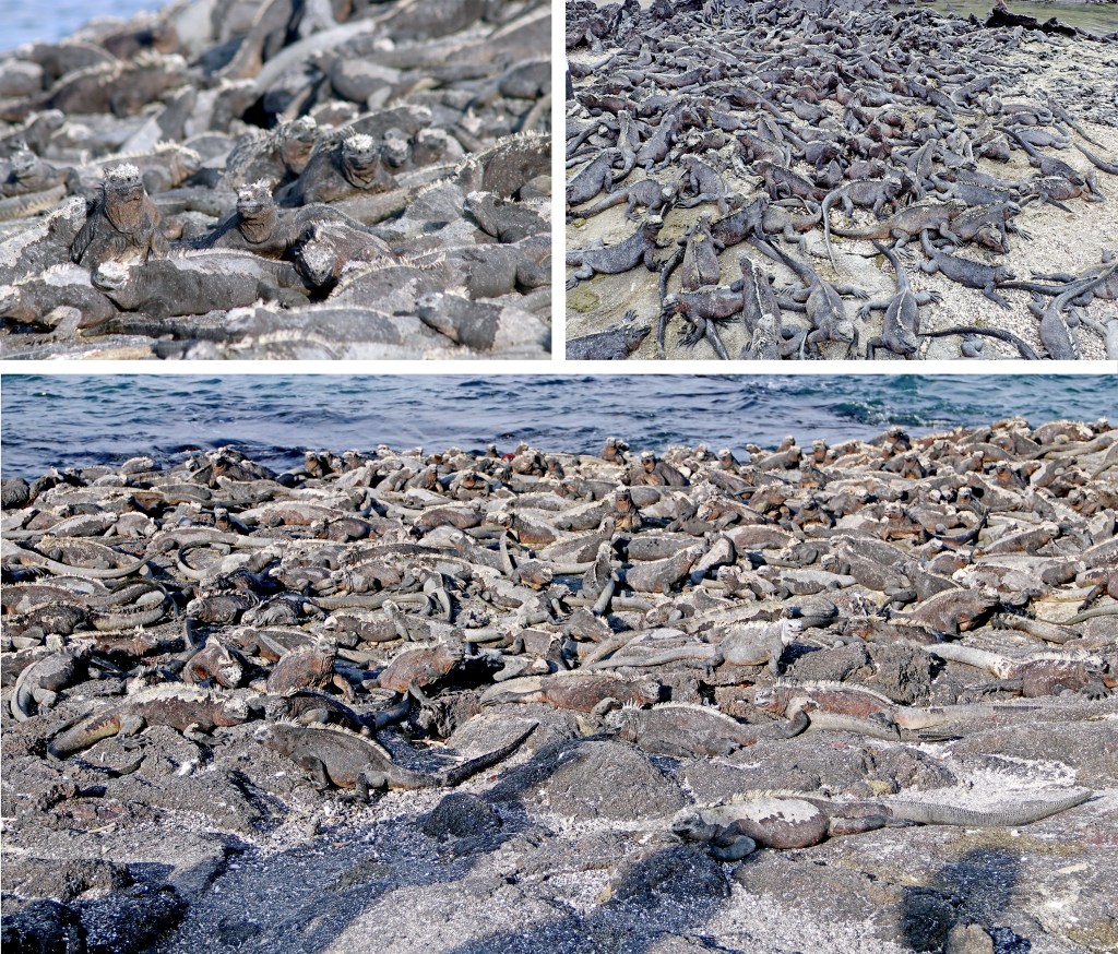
The trail on the right is a sand-covered pahoehoe lava spit that is the home to one of the largest colonies of marine iguanas in the islands. The visitor can see them swimming just offshore, and basking in tremendous numbers on the black lava rocks.
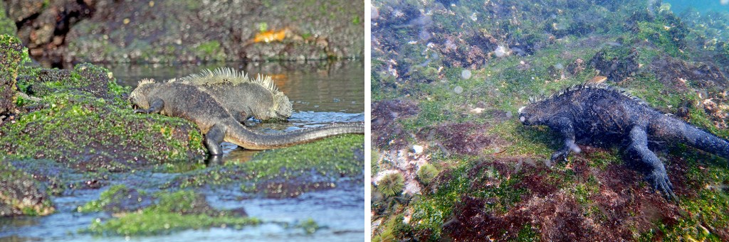
Marine iguanas engage in two foraging modes – intertidal and subtidal. Smaller iguanas are intertidal feeders and one can usually see them feeding along the shore. But Punta Espinoza is the best place in Galápagos to see subtidal feeding. At one time, snorkeling was allowed right in front of the main colony, but now it has been relocated to a nearby cove. At that spot, a snorkeler can see many iguanas feeding under water, but timing is the key. While intertidal feeding depends on the time of low tide, to expose the seaweed that the iguanas eat, larger iguanas are independent of tides and feed around the same time every day regardless of the time of low tide, typically late morning to early afternoon. Subtidal feeders time their forays such that once they emerge cold, they can warm up quickly enough to efficiently digest their meal by the end of the day. Visitors who arrive in the afternoon will not be able to see subtidal feeding. The sandy part of the trail is also an area where marine iguanas dig nests.
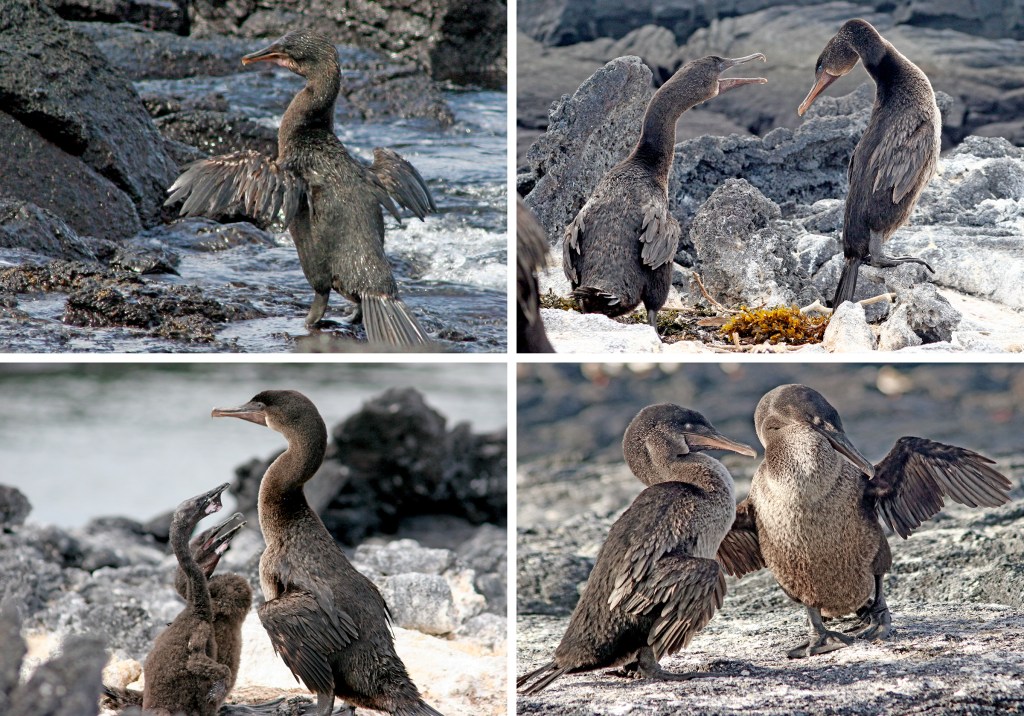
The highlight of the trail is the colony of flightless cormorants. Over the many times I have visited here, the numbers and types of activities have varied. In some years there have been only a few birds, in others, many. During the 2016-17 El Niño I saw none at all, only the scattered bones of dead marine iguanas. In different years I have seen nest building, pair bonding, parents feeding young. It is always hard to predict what you will see, but you will never be disappointed — usually.
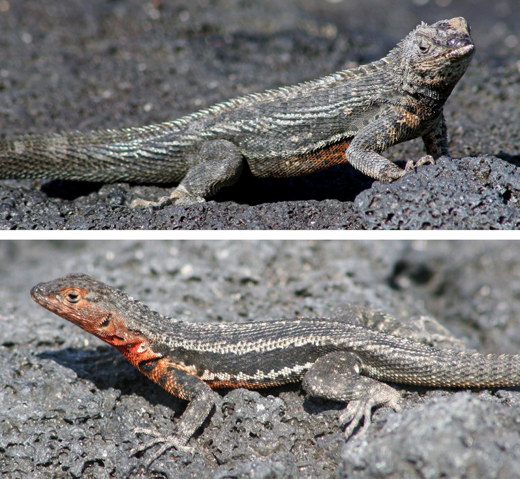
Also, watch for small lava lizards. The lava lizards here are mostly black, but are, in fact, the same species that one sees on nearby Isabela (Microlophus alblemarlensis). The bright red throats of the females make a startling contrast.
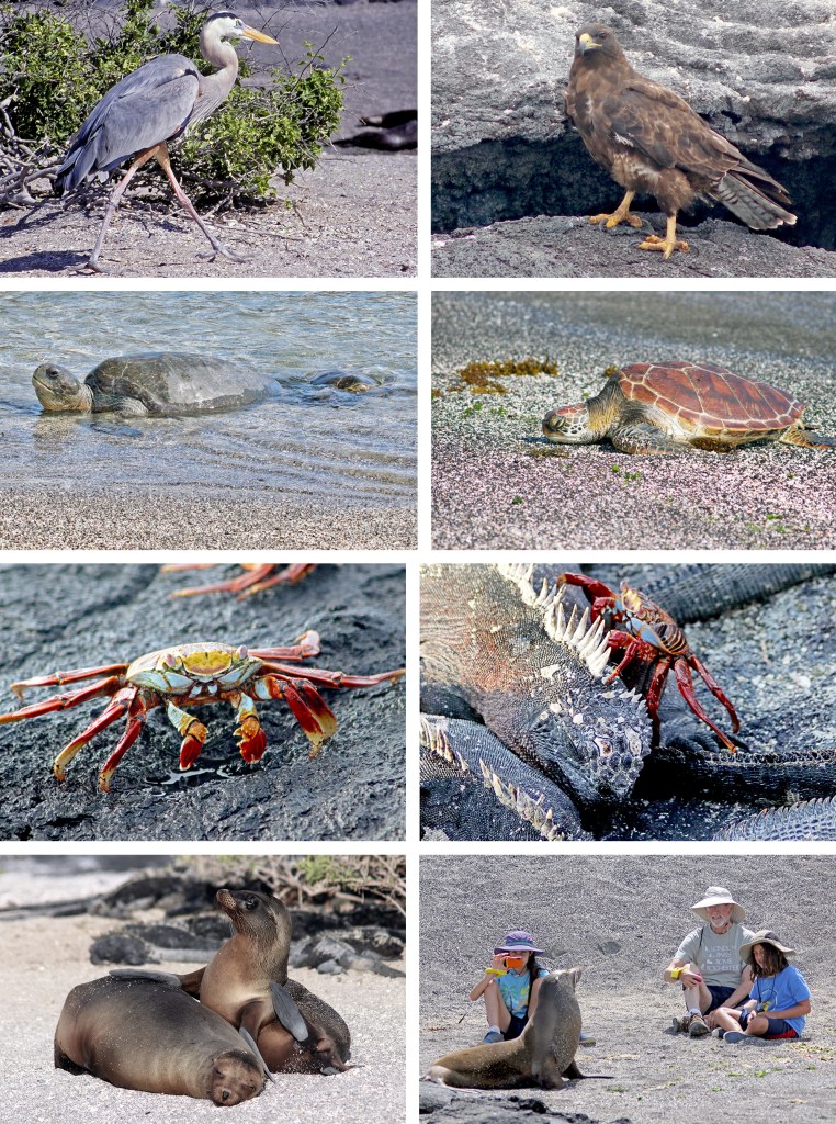
One might also see Galápagos hawks or great blue herons stalking marine iguanas and lava lizards. Occasionally green sea turtles crawl up out of the water to rest for a while before returning. Note that there are two distinct morpotypes of green sea turtles in the Galápagos, black (left in photo below) and yellow (right).And, of course, there are the ubiquitous Sally lightfoot crabs and sea lions.
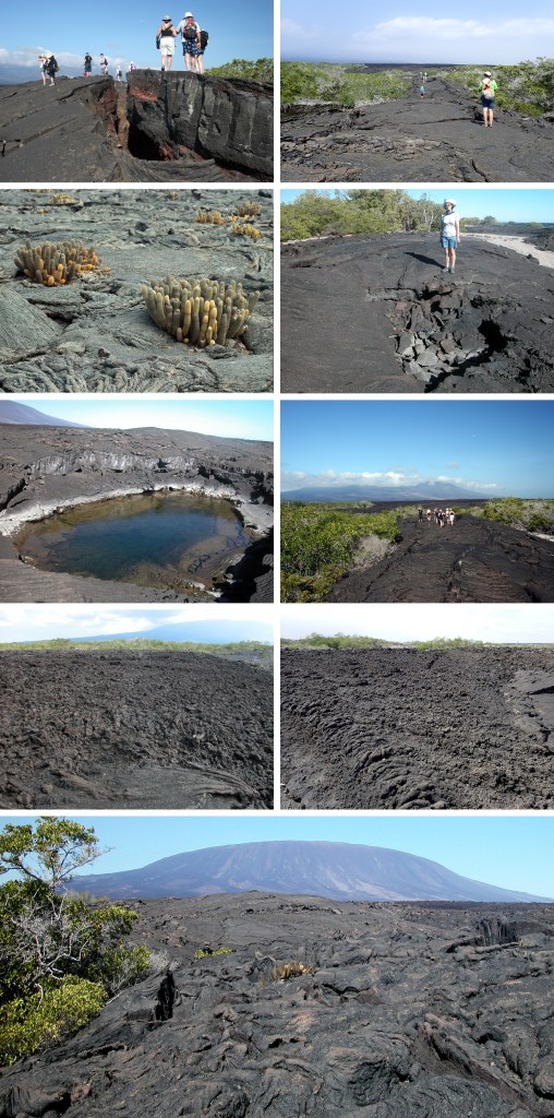
The second part of the trail leads inland across a young pahoehoe flow, generally believed to have been formed by the eruption that Captain Benjamin Morrell witnessed in 1825. It follows a ridge of lava that has fissured along the top. During the eruption that formed this flow, lava accumulated underneath the solidifying crust causing it to swell into a ridge (a tumulus) that eventually cracked from the pressure. In several spots the surface of the flow has collapsed to reveal the empty space below in which lava originally flowed. Lava cactus (Brachycereus nesioticus), an early colonizer of lava flows, is scattered across the trail, and the trail is flanked by thick littoral zone vegetation. A bit farther out, past the vegetation, the trail opens up to a vast, empty lava field. There are several small pools in the barren lava containing fish that swam into them when young but are now too big to swim out. In a tide pool near the trail one can see a large engine block, the remains of the tuna fishing boat, Radio, that ran aground in 1934. Near the end of the trail, the pahoehoe flow merges into an enormous a’a flow, and a spectacular view of Volcán La Cumbre. It is at this point that I like to read Morrell’s account of the eruption. It is hard to escape the feeling that at any moment……..
- Common Animals:
- Marine Iguana (Amblyrhynchus cristatus)
- Galápagos Lava Lizard (Microlophus albemarlensis)
- Flightless Cormorant (Phalacrocorax harrisi)
- Galapagos Penguin (Spheniscus mendiculus)
- Blue-footed Booby (Sula nebouxii)
- Green Sea Turtle (Chelonia mydas)
- Galápagos Sea Lion (Zalophus californianus)
- Galápagos Snake (Alsophis dorsalis or A. slevini)
- Galápagos Hawk (Buteo galapagoensis)
- Great Blue Heron (Ardea herodias)
- Common Plants:
- Saltbush (Cryptocarups pyriformis)
- Lava cactus (Brachycereus nesioticus)
- Galápagos Shore Petunia (Exedeconus miersii)
- Black mangrove (Avicennia germinans)
- Red mangrove (Rhizophora mangle)
- White Mangrove (Labuncularia racemosa)